176
résultats dans
Place
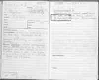
Östra Ljungby socken
Socken i Skåne
Stone bridge, 15 m l (SV-NÖ) and 4.5 m br. 2 span, 4 m l and about 3 mh. Built from tufted graystone, 0.5-1 m pcs. Applied with iron railing comb 8 stone poles. Suspended for traffic. OBS. Free-external is not quality assured. Information may be missing o…
Approximately 50 m Ö on the road for use (N-S) and 15 m SÖ on the stone yard (NÖ-SV).; Weak S-slope of moraine height Forest land (spruce forest).
Hole road, about 150 m l (NÖ-SV) 2-2.5 m br and 0.3-0.5 m dj. The SVhalf has the nearest flat bottom with wheel tracks. Connecting in SV to the road of use. Beer mills with a smaller stream. OBS. Free-external is not quality assured. Information may be mi…
Iron production site, unknown extent. Farmers A Möllerhar has observed, in agricultural work on the field, slag lumps “small and large” and has in custody a slag lump of about 2.5 kg with clear imprints after carbon cubes. A Möller (f 1891), Ö Ljungbyskog…
Hole road, about 100 m l, 2 m br and 0.1-0.3 m dj. OBS. Free-external is not quality assured. Information may be missing or incorrect.; The N part of the hole road cuts the stone yard (ÖSÖ-VNV) about 30 m VNV repetition point between two stone yards.; N- …
Rest stone, 0.8 m h, 0.8 m br at the base and 0.45 m at the top (ÖSÖ-VNV) and 0.4 m tj. Probable formation of nature. Incidentally, the crown of the moraine wool is deregulated in the late era. OBS. Free-external is not quality assured. Information may be…
6.5 m NNV about NV corner of residential buildings. The edge of a farm plan.
High, 15 m diam, 1.5 m h. Damaged in Ö the dragon and rim genre material seal, 7x4 m (N-S) and now to the bottom layer. OBS. Free-external is not quality assured. Information may be missing or incorrect.; On a Moraine Back (NÖ-SV). Åkerholme in arable lan…
High, 11 m diam and 0.8-0.9 m h. In the surface single stones 0.1-0.2 mst. In the middle a pit, 3 m diam and 0.2-0.3 m dj.Even S the edge slightly damaged probably by superficial material seal.Bevuxen with 6 oaks and bushes of rowan and hawthorn. OBS. Fre…
No 30.; 46 m VSV about corner of a stone yard and 22 m SSV about a stone yard (ÖSÖ-VNV).; Adjacent and SÖ about smaller crown in moraine soil. Hagmark
Slagging, examined and removed. See ATA dnr 5672/76. OBS. Free-external is not quality assured. Information may be missing or incorrect.; Arable land.
High, remnant of, 17 m diam and 0.7-1m h. Of the mound, the steeple rim parts of NÖ and S, 16x5 m (Ö-V) and 0.3 m h, 8x3 m (N-S) and 0.1 m h and 5x2 m (Ö-V) and 0.3 m h. Most of the pile was discarded about 90 years ago in association with quarry. OBS. Fr…
Stone setting, round, with a square center stone setting. The round-load is 12 m diam and 0.3 m h. Filling of partial cross moss 0.1-0.3 m pcs stones Visible edge chain brushes, 0.2-0.3 m pcs. The square center stone set is 6 mi side (ÖNÖ-VSV) and raise……
Finding place, for 1 thin-coated grinded flash axe. OBS. Free-external is not quality assured. Information may be missing or incorrect.
Rocking, round, about 15 m diam and 0.5 m h. Over-dried filling of 0.2-0.3 m pcs stones. Shaped in the edge of the SÖ at a steep edge has arisen about 0.5 m h. The stone setting’s EN half, which is located on a plot ground, is multi-site damage and chase …
Finding place, for 1 pointed flat-axe. OBS. Free-external is not quality assured. Information may be missing or incorrect.
Stensättning (?), närmast rund, 7 m diam och 0.3 m h. Övertorvadmed enstaka synliga stenar 0.3-0.5 m st. I SV kanten är en grop,2x1 m st och 0.4 m dj. I gropen är några stenar, 0.5-0.8 m st.Beväxt med 4 ekar. OBS. Fritexterna är inte kvalitetssäkrade. Inf…
LMV in Kristianstad 1713, 1.; Pelagic wine on a SV slope. Forest land (deciduous forest).
Living area, 190x150 m (NNV-SSÖ). In the plowed sandy ground, some 20 colours were found, about 0.3-0.7 m diam, with carbon, soot and scurvy stone, single slag pieces of dark brown heavy slag, and single flint rejection. The colours were most abundant in …
A plot of 120x120 m (N-S), extent according to the surveyor map from 1762. The plot is built. Oldest evidence for Övarps village is 1424. OBS. Free-external is not quality assured. Information may be missing or incorrect.
Village farm plot, about 500x100-200 m (Ö-V). Parts of Ö Ljungbystomt according to a map from 1800. The plot is built. 150 m N.V. if no 1 is: 2) Village farm plot, about 200x100 m (Ö-V). The Western Regard Core of the Island of Ljungby according to a ma……
Farm plot, 70x60 m (NNV-SSÖ), extent according to the surveyor map of 1828. The plot is built. Oldest evidence for Kolarehus farmstead from 1613. OBS. Free-external is not quality assured. Information may be missing or incorrect.
Bygården plot, about 200x150 m (Ö-V), Bläsinge säteris f dbläsingeSörgård’s plot according to map of 1762. Situation somewhat uncertain. The Easter Map is only house schablons. The plot is building.Approx 150 m N if no 1 is: 2) Bygårdstomt, unknown ex……
Farm plot, 50x50 m (N-S), extent according to the surveyor map of 1762. The plot is built. Oldest evidence for Rönnaskulla, from 1661. (R) objects in principle. OBS. Free-external is not quality assured. Information may be missing or incorrect.; LMV in Kr…